
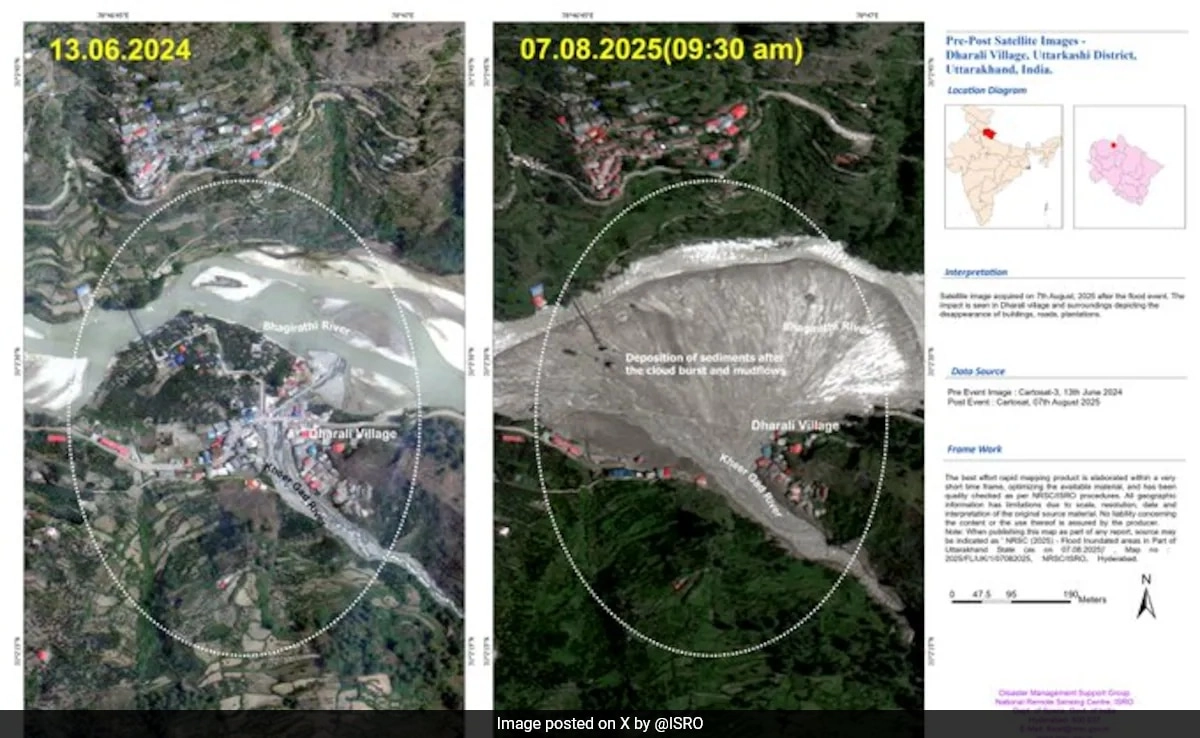
Recent satellite imagery released by the Indian Space Research Organisation (ISRO) has provided critical insights into the devastating effects of floods in Uttarakhand, particularly focusing on the regions surrounding Dharali and the Bhagirathi River. These images depict the extensive damage caused by the surging waters, revealing how the landscape has been altered in a matter of days. The floods, triggered by heavy rainfall and the rapid melting of glaciers, have significantly affected the local communities, infrastructure, and the surrounding ecosystem.
The visuals captured by ISRO highlight the drastic changes in the river’s course, with floodwaters inundating agricultural fields, roads, and residential areas. The Bhagirathi River, known for its scenic beauty and cultural significance, has transformed into a raging torrent, leading to the displacement of numerous families. The impact on agriculture is particularly alarming, as the region relies heavily on farming for its livelihood. With fields submerged and crops destroyed, the economic repercussions will be felt for years, further exacerbating the challenges faced by the already vulnerable population.
In addition to the immediate human toll, the floods pose a long-term threat to the environment. The erosion of riverbanks, loss of soil fertility, and potential contamination of water sources can have lasting effects on the ecosystem. The satellite images serve as a vital tool for researchers and government officials, providing a clearer understanding of the flood’s extent and facilitating timely interventions. Assessing the damage through this advanced technology allows for better planning in disaster management and recovery efforts, ensuring that the affected areas can rebuild and become more resilient to future calamities.
As Uttarakhand grapples with the aftermath of these floods, the need for comprehensive disaster preparedness and sustainable development practices becomes increasingly evident. The insights gained from ISRO’s satellite imagery can aid in creating effective strategies to mitigate the risks associated with extreme weather events. Ultimately, the disaster underscores the importance of addressing climate change and its impact on vulnerable regions, emphasizing the need for a coordinated response to safeguard both human lives and the environment.