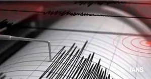
On a recent day, the Andaman Sea experienced a notable seismic event, registering an earthquake of 4.2 magnitude. This earthquake, while not among the most powerful, highlighted the region’s geological activity and the ongoing tectonic movements associated with the boundaries of the Indian and Burmese plates. Earthquakes in this area are relatively common due to its location along the complex tectonic setting of the Himalayan range and the surrounding oceanic plates.
The earthquake struck at a depth of approximately 10 kilometers, which is considered shallow in geological terms. Shallow earthquakes can often be felt more intensely at the surface, leading to concerns about potential damage and safety. However, no immediate reports of significant damage or injuries were made following the earthquake. The local authorities and geological agencies typically monitor such events closely, ensuring that residents are informed and prepared for any aftershocks that may follow.
In regions like the Andaman Sea, where seismic activity is frequent, preparedness and resilience are vital. Communities often engage in earthquake drills and educational programs to ensure that inhabitants know how to respond during such events. Additionally, advancements in technology have improved early warning systems, allowing for quicker responses to seismic activity. Although the earthquake was relatively mild, it serves as a reminder of the importance of awareness and readiness in areas prone to natural disasters.
Overall, the 4.2 magnitude earthquake in the Andaman Sea underscores the dynamic nature of our planet’s geology. While the seismic event did not result in major repercussions, it reiterates the necessity for continuous monitoring and preparedness in seismic zones. The region’s history of more significant earthquakes also emphasizes the importance of building infrastructure designed to withstand potential future quakes, ensuring the safety and security of the communities that inhabit these vulnerable areas.