
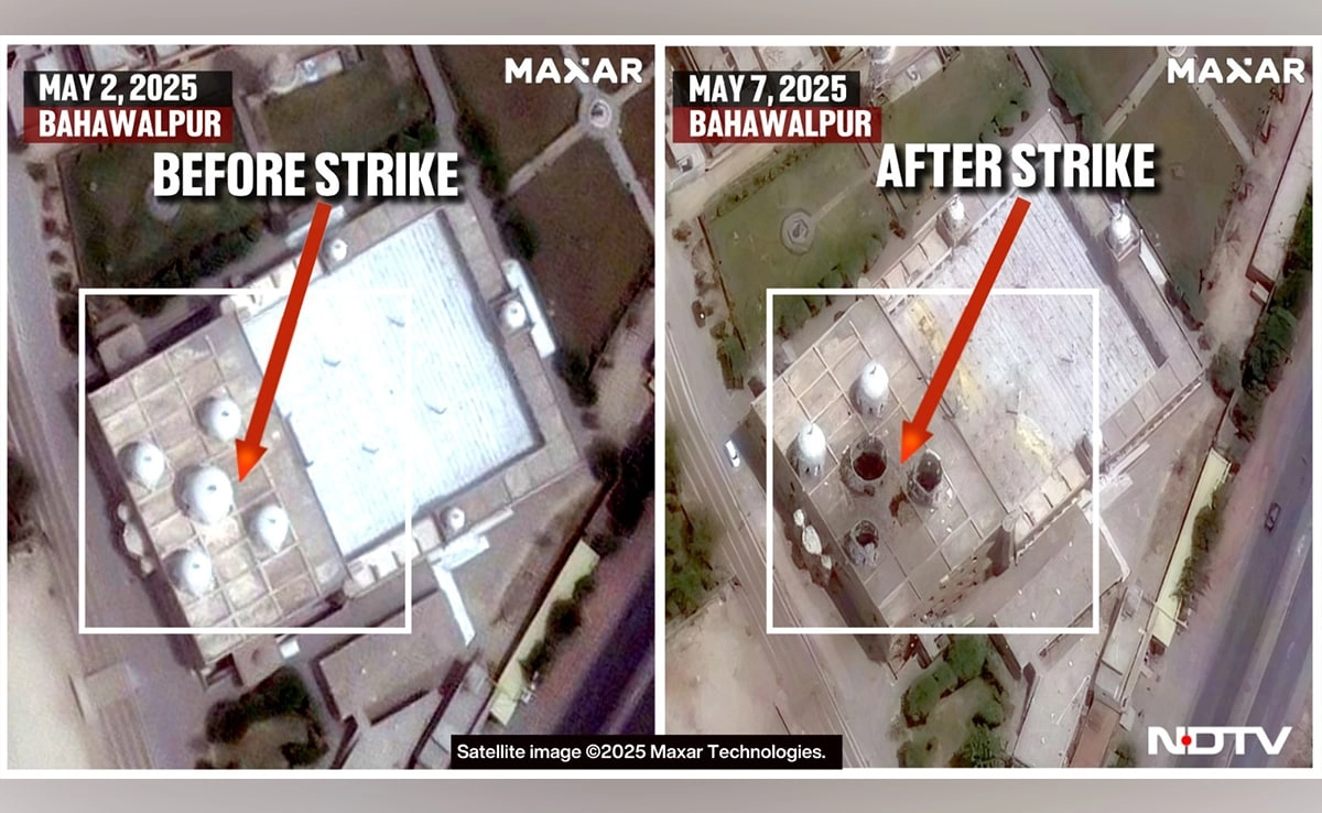
Recent satellite imagery has revealed significant transformations in landscapes previously associated with terror activities, particularly concerning the sites targeted during Operation Sindoor. This strategic military operation aimed at dismantling terrorist infrastructure has led to noticeable destruction of key locations identified as operational hubs for extremist groups. The high-resolution satellite photos illustrate the extent of damage inflicted on these sites, showcasing the effectiveness of the operation in disrupting terrorist networks.
The imagery highlights the obliteration of several buildings that served as command centers, training facilities, and storage for weaponry. The once-bustling areas have been reduced to rubble, indicating a decisive strike against the operational capabilities of these groups. Analysts have pointed out that the destruction of these sites not only hampers the immediate functionality of these organizations but also sends a broader message regarding the commitment to counter-terrorism efforts. The visual evidence underscores the importance of intelligence-gathering and precision strikes in modern warfare.
Moreover, the satellite photos provide a stark reminder of the ongoing conflict and the lengths to which military operations are taken to ensure national security. The marked changes in the terrain reflect the intensity of the operation and the strategic planning behind it. While the destruction of these terror sites is celebrated by some as a victory in the fight against extremism, it also raises questions about the long-term implications for the affected regions and communities. The aftermath of such operations often leaves a vacuum that can be exploited by other militant factions, necessitating a comprehensive approach that includes rebuilding efforts and community engagement to prevent the resurgence of violence.
As the global community continues to grapple with the challenges posed by terrorism, the insights gained from these satellite images serve as a vital tool for understanding the evolving landscape of conflict. They not only document the physical changes resulting from military interventions but also contribute to the discourse on effective strategies for counter-terrorism. Ultimately, the imagery from Operation Sindoor encapsulates the complex interplay between military action and the broader goal of achieving lasting peace and stability in regions plagued by violence.


